


Entering the Year Field
Select the beginning and ending year for which you wish to calculate a temperature trend. For example, if you want to calculate a temperature trend between the years 1901 and 1980, click on the Beginning Year button and scroll down to select the year 1901. Likewise, click on the Ending Year button and scroll down to select the year 1980. The year field button would now appear as shown below:
Entering Latitude and Longitude Grid Coordinates
Individual station temperatures in both the GHCN and Jones et al. temperature datasets have been aerially averaged into grid boxes of 5° latitude by 5° longitude. As such, latitude and longitude values for these data sets may be selected at 5-degree increments. A smaller grid-box size of 2.5° latitude by 2.5° longitude is available for selection for the MSU data set. Area selection for the Upper-Air Radiosonde (Balloon) data set is available in latitude bands only, as described in its data set description.
Latitude degrees south of the equator are designated by a negative sign, latitude degrees north of the equator by a positive sign. For example, 40°S latitude would correspond to -40, and 40°N latitude would correspond to 40. Longitude degrees west of the Prime Meridian are designated by a negative sign, longitude degrees east of the prime meridian by a positive sign. For example, 135°W longitude would correspond to -135, while 135°E longitude would be listed as simply 135.
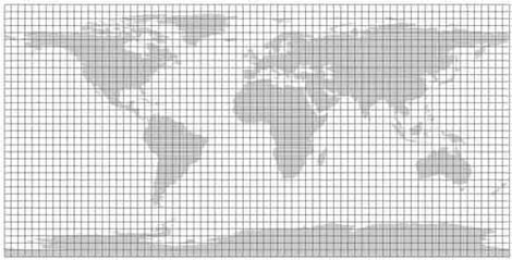
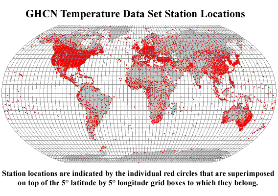
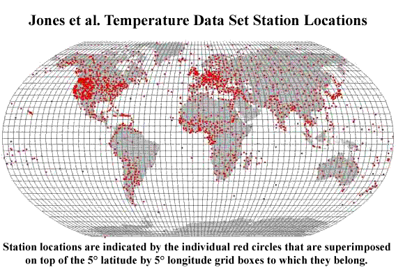
Be aware that for many of the oceanic regions there exist no temperature data. Thus, when attempting to calculate temperature trends in such regions, a message of "no data" is returned because there are no data to calculate trends. A graphic of the station locaitons used in the GHCN data set can be found here, while one for the Jones et al. data set can be found here. If you are having difficulty determining the latitude and/or longitude grid coordinates for a given area of the globe, consult the graphic below. Using your mouse, click on the center of the region you wish to examine. The ensuing link will bring you to a more detailed graphic of that region and will display the appropriate grid coordinates.